Authors: D. Calderone, G. De Giorgio
Download article as .pdf: Archaeology and geomorphology of an area: new interpretations of long-term settlement logics from Prehistory to the Byzantine period across the central-eastern slopes of the Etna volcano
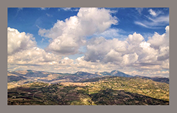
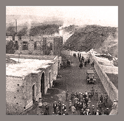 The archaeological analysis of Sicilian territories between the Ionian coast and the Etna central-eastern slopes has historically posed challenges for archaeologists. For a long time, it was believed that the interpretation of archaeological data was completely compromised by the marshy nature of the coastal areas, intense human activity through time, and the impact of numerous lava flows, especially in higher altitude areas like the municipality of Mascali (CT). This town was destroyed in the 1928 eruption. This study addresses these challenges by combining the extant archaeological evidence with the study of the geomorphology and geology of the area, especially the superimposition of the various settlements in the region from prehistory to Late Antiquity to shed light on how different human communities inhabited the area over the centuries. Combining information from known archaeological contexts with the geomorphological study of the landscape makes it possible to gain a deeper understanding of the relationship between humans and their local environment. The presence of archaeological sites in correspondence with specific geological formations, such as essential deposits of blue clays, elucidates the relationship between natural resources, settlements, roads, and ports. This, in turn, enables the formulation of new hypotheses regarding the exploitation of the land, with particular reference to the Roman and Byzantine periods, highlighting the strong links between this area of Sicily and those further North, in correspondence with the port of Naxos (modern Giardini-Naxos, ME).